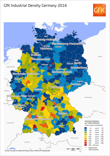
GfK’s Map of the Month for January shows the industrial density at the level of Germany’s urban and rural districts (source: GfK Base Data, Germany). The map depicts the number of employees working in industrial companies per 1,000 inhabitants.
The map may be freely distributed and reproduced if the following attribution is included: “Illustration: GfK”.
About GfK
GfK is the trusted source of relevant market and consumer information that enables its clients to make smarter decisions. More than 13,000 market research experts combine their passion with GfK’s long-standing data science experience.This allows GfK to deliver vital global insights matched with local market intelligence from more than 100 countries. By using innovative technologies and data sciences, GfK turns big data into smart data, enabling its clients to improve their competitive edge and enrich consumers’ experiences and choices.
Additional information can be found at www.gfk.com/geomarketing.


