
CRESTA Zones
Analyze, aggregate & exchange risk-related insights with the most widely used standard in the (re)insurance industry.
CRESTA Zones 2026 and NIQ boundary data
Turn information into insights
CRESTA Zones give insurers, reinsurers, modelers, regulators and other industry professionals a universal global standard for analyzing, aggregating and exchanging risk-related insights. Link your information to a worldwide boundary structure to pinpoint trends and then share results with unmatched accuracy and speed.
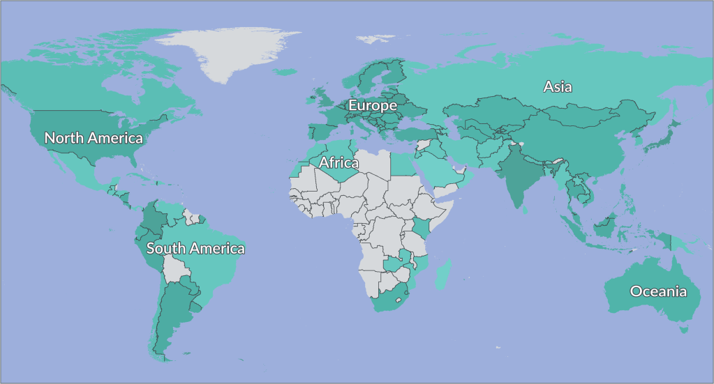
Created in collaboration with PERILS AG, the current CRESTA Zones offer coverage of 140 countries and are based on NIQ Geomarketing’s global map set of postal and administrative boundaries 2026. To quantify the area changes caused by NIQ’s regular map updates with regard to the current CRESTA version we continuously provide CRESTA Assignment Tables. Given their status as an industry benchmark, CRESTA Zones function similarly to a currency in the market, which is why they are updated less frequently every 5-7 years.
“As a globally adopted standard for the exchange of insurance data, CRESTA Zones play a critical role in both assessing risk and communicating insights. NIQ’s (previously GfK) proven cartographic expertise and high-quality geodata ensure that this important product meets the evolving demands of the insurance industry.”
— Dr. Christoph Oehy, CEO PERILS AG
How you benefit
- Analyze & aggregate risk – worldwide
Turn information into insights by aggregating and comparing your risk data in 140 countries. - Use within your insurance applications
Select from two zone resolutions to analyze exposures, model catastrophes, underwrite policies, adjust premiums, track loss volumes and more. - Plan using reliable boundaries
The boundaries of our CRESTA Zones fit together seamlessly, without gaps or overlaps. This supports error-free and robust analyses. - Share insights while protecting privacy
Safeguard sensitive information thanks to aggregation options. - Avoid errors along coastlines
Manually digitized boundaries along coastlines ensure waterfront buildings and real estate fall within the zone structure.
Highlights of the 2026 CRESTA Zones
expanded coverage
Link your data to zones in 140 countries.
flexible aggregation options
Select from 4,814 low-resolution zones and 247,202 high-resolution zones depending on the task at hand.
high-quality coastlines
Plan with greater precision along coastlines thanks to boundaries that accurately outline inlets and waterfront real estate.
improved assignment tables
Compare vintages of CRESTA Zones with the latest postcode and administrative boundaries using an area share allocation feature.
compatible with other NIQ geodata
Enhance your risk analyses by seamlessly combining CRESTA Zones with NIQ’s market data.
Meet us 2026 at the following reinsurance events:
- March 10-11: Exponential Risk London 26
- October 18-21: Baden-Baden Reinsurance Meeting
Availability
Download

Catalog
Download

Guided Tour
Download

Samples
Download